December 03, 2015
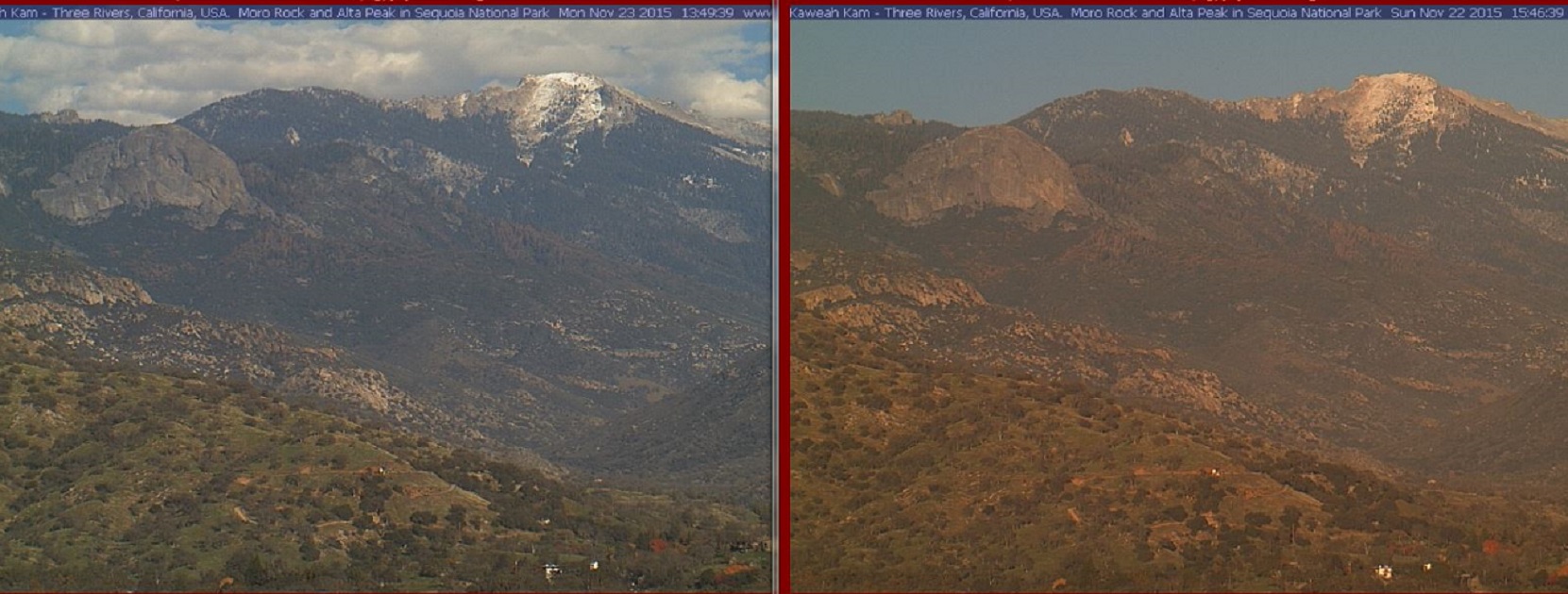
Today, the first in a series of early December storms will roll across portions of Oregon and Northern California. Inches of rain and feet of snow driven by winds to hurricane force will impact this wide region Thursday the 3rd into Friday the 4th of December.
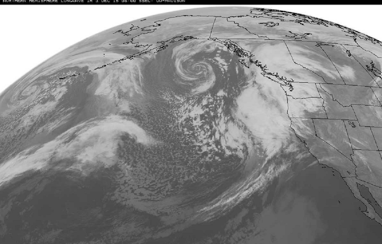
The image below is from late Wednesday, the storm is poised just off the coast.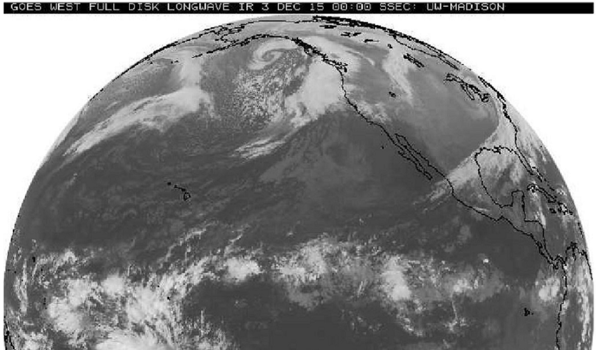
Closer view 8 hours later, early Thursday morning 0800z. Solid cloud cover associated with steadier precipitation. Speckled clouds west side of storm system a sign of cold air streaming south and a vigorous strengthening system. Big storm … today.
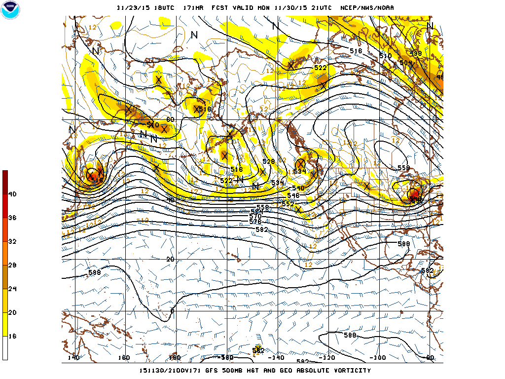
Forecast map for Thursday morning December 3rd from this Blog post a week ago.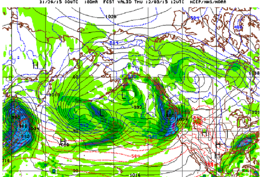
Forecast map for Thursday morning December 3rd from Wednesday evening.
Compare storm location and strength of system approaching West Coast, also notice Southeast storm in reality has already moved out.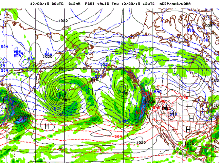
So, this particular run of the model did a little better with timing on the West Coast system. As we look ahead a few more days to this weekend. This “particular run of the model” begins to take on the “atmospheric river” configuration that the West Coast and especially California needs to be ready for as the more serious winter storms appear to be upon us.
A series of storms spread across the Pacific Ocean all headed toward our West Coast and portions of California, but not necessarily Los Angeles or San Diego, at least not at first. This first series of storms appears to target the Southern Cascades, the Siskiyou, and the Northern Sierra Nevada. Southern California may do better with a system toward the end of the series around Thursday the 10th. 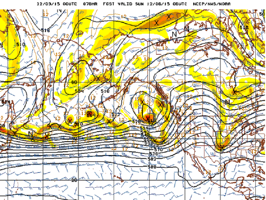
It really is quite the chart. A straight shot right across the Pacific. The search for a good example of the Pacific “atmospheric river” for Chapter II of the book took me back to January of 2010. Now here we are early December 2015 with one of the strongest El Niño ever and the forecast model just starts spitting out great examples of this relatively rare phenomena.
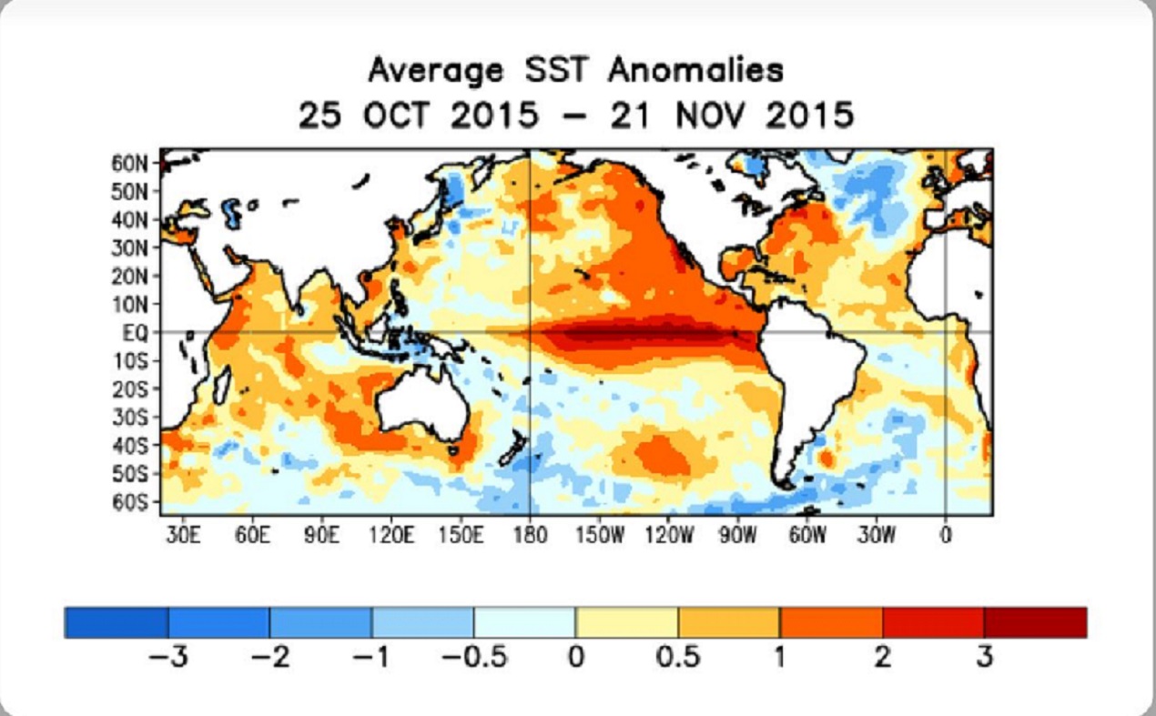
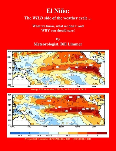
The average SST (sea surface temperature) anomaly for November 2015 was +2.98. A three month running average of 1.50 is considered significant.
A long and eventful Meteorological Winter has indeed begun.
Learn more in my latest e-book El Niño: The WILD side of the weather cycle…
What we know, what we don’t, and WHY you should care!
I show how this years Pacific water temperatures compare to the 1982 and 1997 events and highlight the kind of weather episodes that these stronger El Niño’s tend to bring.
If you like the blog you will love the book.
Wild Bill.