January 28, 2016
Our El Niño winter has delivered an incredible snowstorm to Washington, Baltimore and New York City.
January 24, 2016 snowstorm totals for selected Washington, Baltimore and New York locations.
Location Storm total record/storm
DULLES INTERNATIONAL 29.3 1230 AM 1/24 AIRPORT 32.4 Feb 05, 2010
BWI AIRPORT 29.2 1230 AM 1/24 AIRPORT 26.8 Feb 16, 2003
Location Storm total calendar day total record/day
CENTRAL PARK 26.8 100 AM 1/24 ASOS 26.6 / 24.1 Feb 12, 2006 NYC/JFK AIRPORT 30.5 100 AM 1/24 FAA OBSERVER 30.3 / 21.6 Feb 17, 2003
NEWARK AIRPORT 28.1 100 AM 1/24 FAA OBSERVER 27.5 / 25.9 Dec 26, 1947
NYC/LA GUARDIA 27.9 100 AM 1/24 FAA OBSERVER 27.9 / 23.3 Feb 12, 2006
There are many different ways to report snow amounts. There are storm totals, calendar day amounts(Midnight to Midnight), and amounts in other 24 periods,(example, daily obs are 12z or 7amEST). So it can get a little confusing when determining what is an actual record and what is close to a record.
For the Baltimore Airport and most of the New York City area these are indeed record amounts of snow.
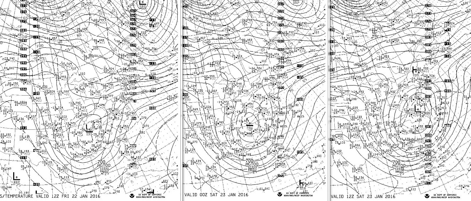
700mb charts below show the storm blossom and slide more east than north focusing the punch at the Mid-Atlantic. However mature circulation does manage to reach as far north as NYC area by Saturday morning the 23rd.
Friday morning 22nd Friday evening 22nd Saturday morning 23rd
17th, …. 5 days before Blizzard subtropical plume from El Niño region already established. The plume reaches from the equatorial Pacific across Mexico and the Gulf Of Mexico into Georgia, Florida and the Southeast.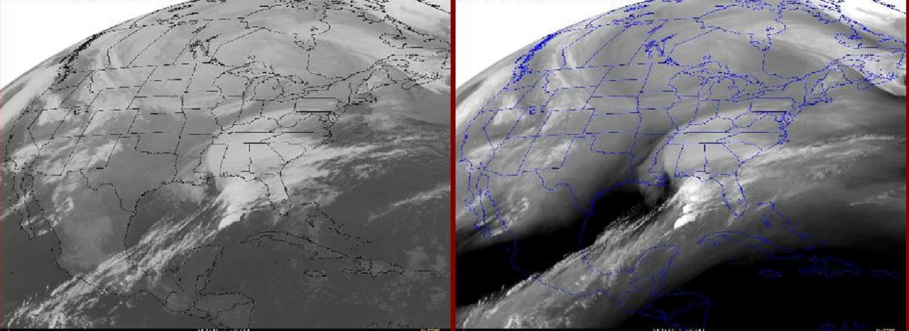
19th, … Disturbance over SE has moved away but the tropical plume remains.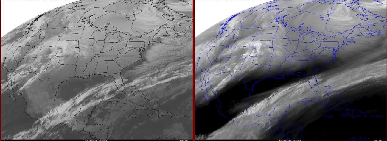
21st, … new disturbance southern plains, tropical plume broadens 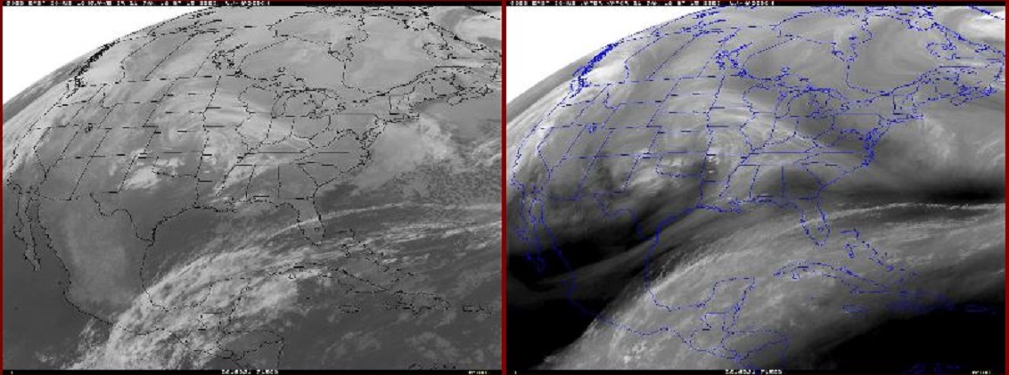
22nd early, … new disturbance gaining strength while approaching but not yet directly connected to the plume.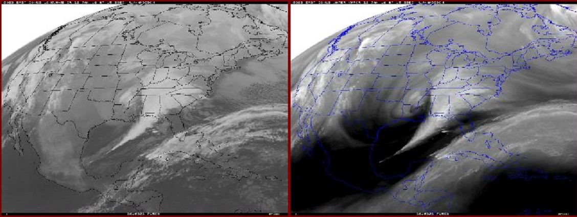
22nd late, …maturing storm system mergers with tropical plume,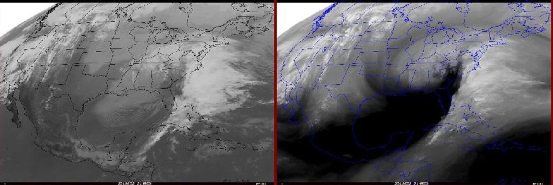
23rd early, … and throws the moisture into below freezing air across Mid-Atlantic.
Quite impressive, impressive enough to challenge all time snowfall records in several major East Coast cities. Below other El Niño related events in recent weeks, ….
January 08, 2016 Bonnet Carre Spillway to open to divert water out of Mississippi River.
January 09, 2016 CAPE CORAL TORNADO EF-2 January 15, 2016 FORT MYERS TORNADO EF-1 January 17, 2016 SARASOTA TORNADO EF-2, Fatalities 2 January 27, 2016 POMPANO BEACH EF-1
Mississippi River floods, East Coast snowstorms, and Florida tornadoes oddly enough are all in my latest e-book El Niño: The WILD side of the weather cycle…
What we know, what we don’t, and WHY you should care!
I show how this years Pacific water temperatures compare to the 1982 and 1997 events and highlight the kind of weather episodes that these stronger El Niño’s tend to bring.
If you like the blog you will love the book.
Update on the west coming soon,
Crater Lake entrance in December: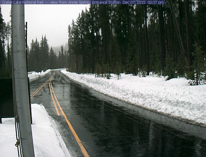
Crater Lake entrance Tuesday January 26, 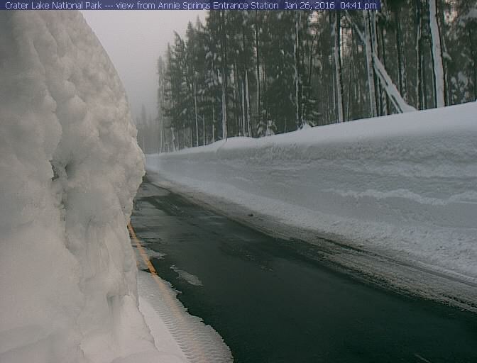
Wild Bill.
