December 01, 2015
Despite a slight decrease in weekly SST’s this week, a +3.0 for the final week of the month was warm enough to give November a record high average. The average SST (sea surface temperature) anomaly for November 2015 was +2.98. The warmest month previously was January of 1983 at +2.79. The warmest month in record season of 1997 was December at +2.69. Values used for my calculations listed below were retrieved from the CPC’s website.
———————————————————————————————————————-
Latest weekly SST’s for the 3.4 Niño region
04NOV2015 29.5 +2.8 05NOV1997 29.2 +2.6
11NOV2015 29.7 +3.0 12NOV1997 29.3 +2.7
18NOV2015 29.7 +3.1 19NOV1997 29.3 +2.7
25NOV2015 29.6 +3.0 26NOV1997 29.4 +2.8
Nov. average 29.6 +2.975 29.3 +2.700
———————————————————————————————————————-
Warmest monthly SST’s for the 3.4 Niño region
YR MON NINO3.4 ANOM
1982 12 29.21 +2.64
1983 1 29.36 +2.79
1997 11 29.32 +2.67 (29.3 +2.700)
1997 12 29.26 +2.69
2015 10 29.15 +2.46
2015 11 29.60 +2.98
The monthly averages will be officially update on the CPC website later this week, we will revisit the subject at that time.
———————————————————————————————————————
A graphical representation of the current Eastern Pacific warming compared to last year and the year before.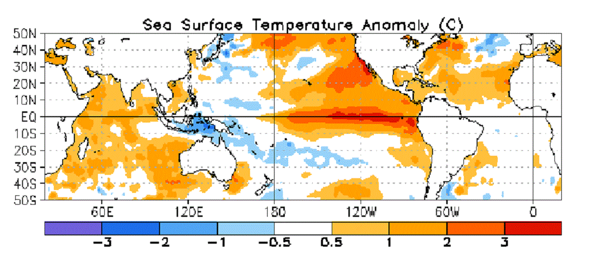
November 2014, last year, just a hint of the coming event.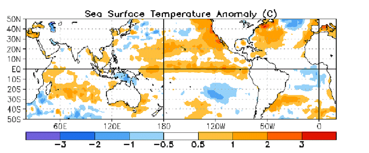
November 2013, two years ago, nothing of note in the eastern Pacific.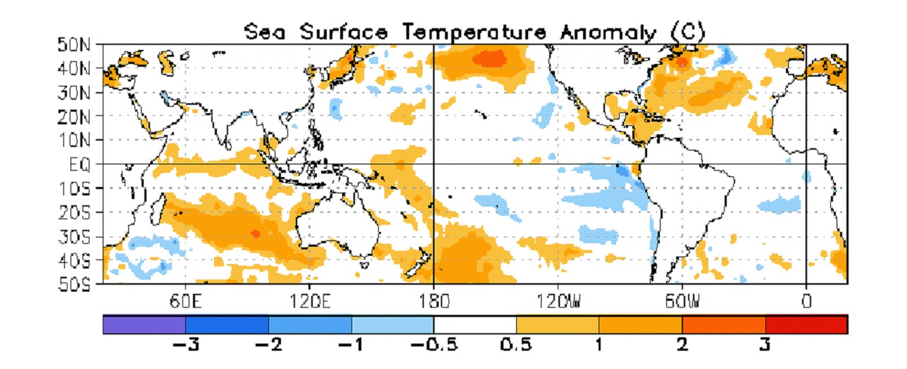
This El Niño event is a big deal. I am afraid the real “fun” has barely begun.
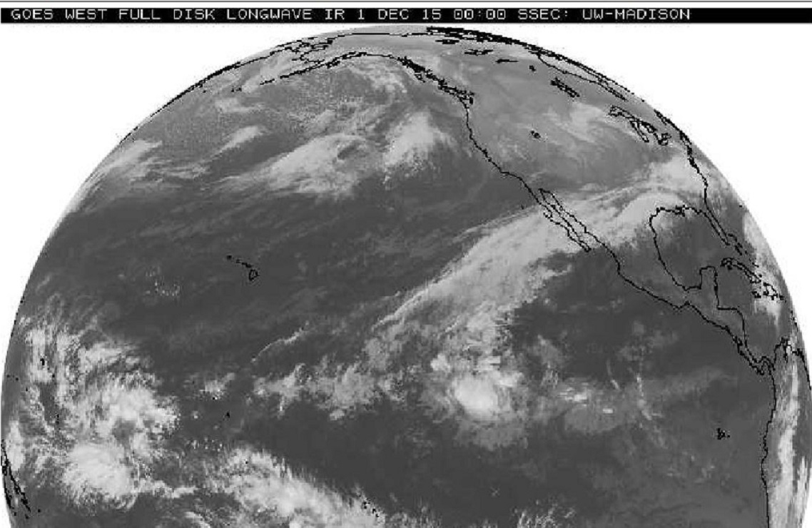
Monday evening satellite image clearly showing the moisture connection from the Eastern Equatorial Pacific into North America. Tropical systems Rick and Sandra are long gone but the tropical connection to the 3.4 Niño region persists in the early days of December.
Here is a couple of quick lines from Chapter IV of my book that illustrate why this connection can be a winter long problem.
“The impact of the 1983 El Niño was pretty far reaching right here in the U.S. A winter so wet, over such an expansive area, that two of our biggest river basins were still above flood stage entering the summer months. Pacific Ocean temperatures as warm as 1983 at this point in the season is NOT a good thing.”
“the two biggest floods on the Lower (Mississippi) River Basin, … have been during Pacific warming events.”
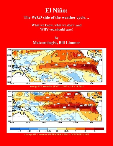
Learn more in my latest e-book El Niño: The WILD side of the weather cycle…
What we know, what we don’t, and WHY you should care!
I show how this years Pacific water temperatures compare to the 1982 and 1997 events and highlight the kind of weather episodes that these stronger El Niño’s tend to bring.
If you like the blog you will love the book.
Wild Bill.