October 20, 2015
The newest weekly sea surface temperatures have been posted with no big surprises. Maintaining a +2.4 for another week means our event remains robust. Trailing 1997’s record pace by one tenth of a degree is almost as trivial as it sounds. The last seven weeks are just about a carbon copy of 1997’s record level.
02SEP2015 28.9 +2.1 03SEP1997 28.9 +2.1
09SEP2015 29.0 +2.3 10SEP1997 28.9 +2.2
16SEP2015 29.0 +2.3 17SEP1997 28.9 + 2.2
23SEP2015 29.0 +2.3 24SEP1997 28.9 +2.2
30SEP2015 29.1 +2.4 01OCT1997 29.1 +2.4
07OCT2015 29.1 +2.4 08OCT1997 29.2 +2.6
14OCT2015 29.1 +2.4 15OCT1997 29.2 +2.5
Strong hurricanes usually don’t hang out near 140-150W latitude, the tropical Pacific Ocean southeast of Hawaii. Olaf is now a Category 4 with 140mph winds currently headed west in the general direction of Hawaii. The storm’s existence as well as its location is natures sign or testimony that the El Niño warming of Eastern Pacific is in deed in progress. 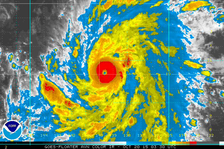
The broader picture shows Olaf in reference to Hawaii and the Eastern Pacific.
Tuesday October20, 2015 03z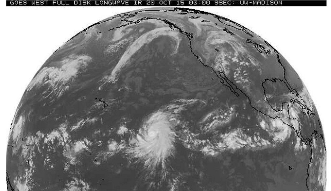
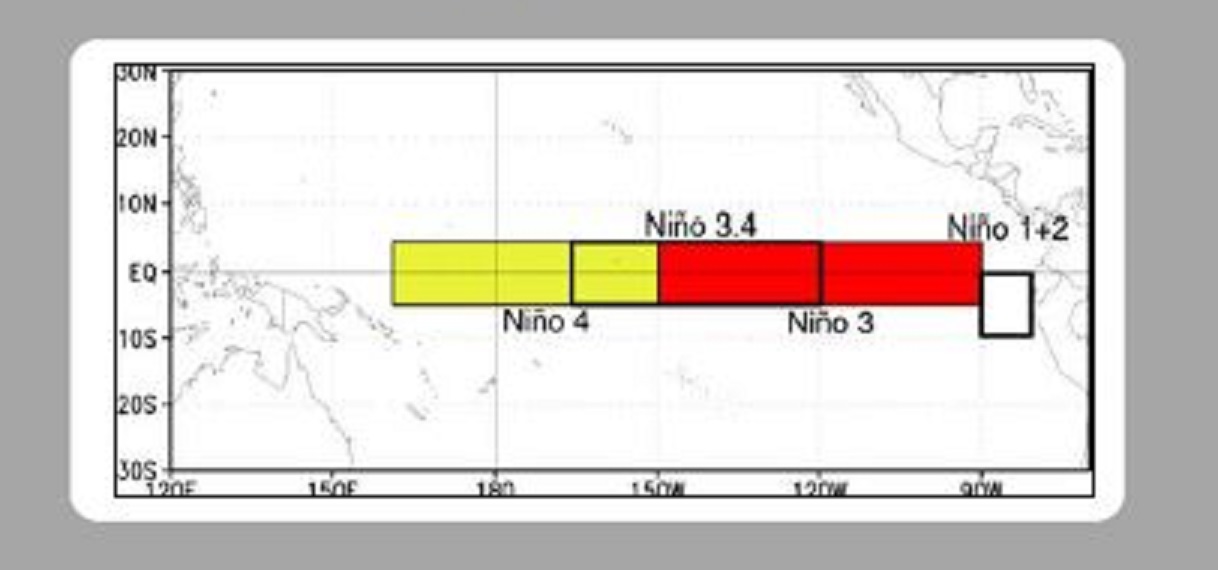
The Nino 3.4 Region runs 120-160W, 5 degrees north and south of the Equator, or just south of where our hurricane is tracking. So the storm has intensified very near the warm region of interest. But in doing so, the circulation of the storm stirs up the ocean surface and actual works to lower the sea surface temperature through vigorous mixing.
So, our current weekly sea surface temperature might be a little higher if it were not for this developing hurricane right in the Nino3.4 neighborhood.
Covered the forecast for Monday October 19, 2015 12z in a couple of blogs. Here are the actual satellite and model surface maps from Monday morning, and one of the forecast maps from 7 or 8 days ago.
Monday October 19, 2015 12z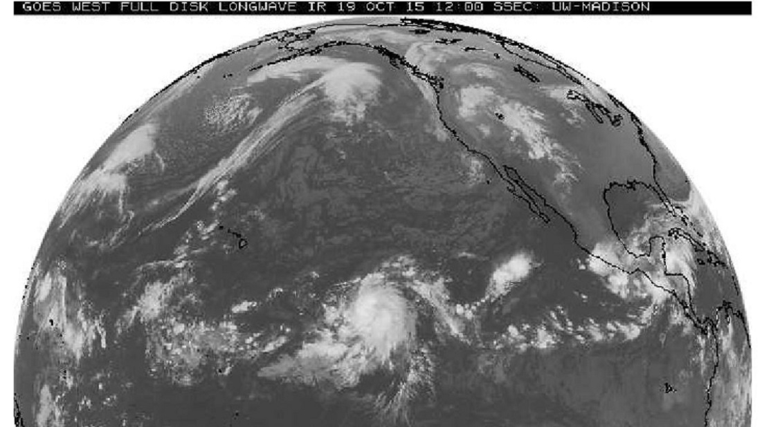
GFS 06z run 006 hour forecast for Monday October 19, 2015 12z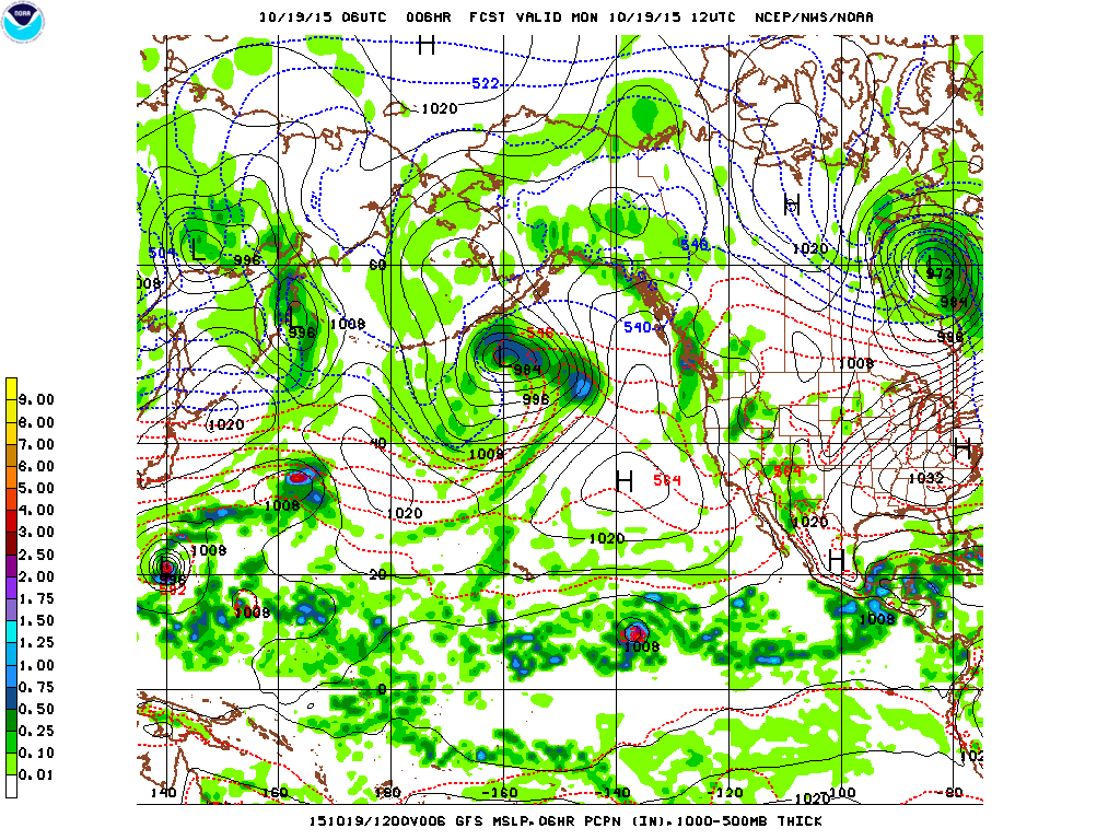
GFS 00z run 204 hour forecast for Monday October 19, 2015 12z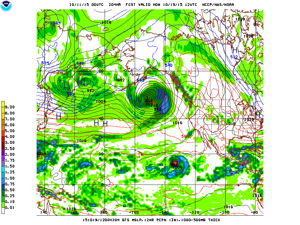
OK, a little surprised, did not see the two panels side by side until this blog. Usually there a few more differences with such comparisons, especially a forecast for a week away. I may have to revisit such analysis in the near future. The idea is to have some forewarning before yet another interstate highway becomes impassable.
Learn more in my latest e-book El Niño: The WILD side of the weather cycle…
What we know, what we don’t, and WHY you should care!

Wild Bill