October 08, 2015 Another Hurricane, and yet another miss for Hawaii. There have been a number of storms that have been in the vicinity of the Hawaiian Islands this season, but none so far, have had the impact that the one tropical storm had last year. But with our current El Niño in full swing, warming the waters of the Central and Eastern Pacific, the threat to Hawaii from tropical systems will continue well into November.
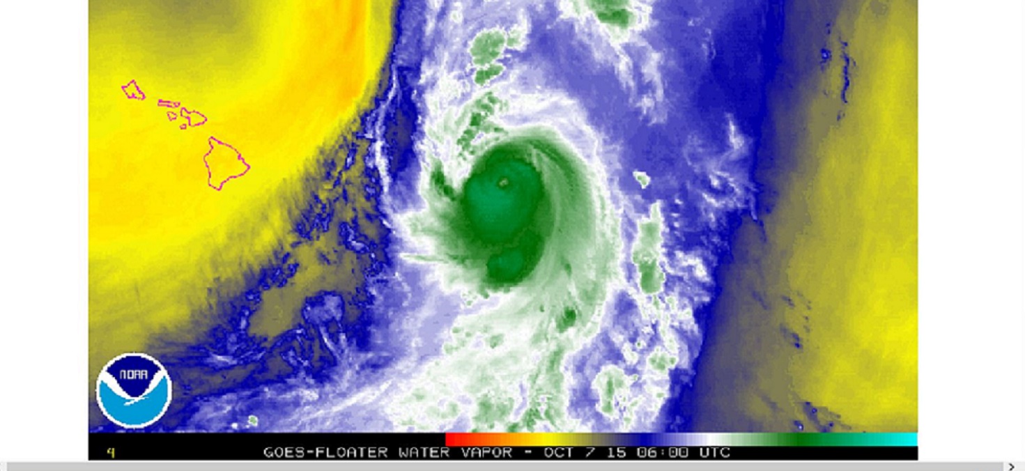
Water vapor picture of Hurricane Oho from early Wednesday morning. The Advisory is from Wednesday afternoon.
Hurricane Oho Advisory Number 020
Issued at 500 PM HST WED OCT 07 2015
SUMMARY OF 500 PM HST…0300 UTC…INFORMATION
———————————————-
Location: 30.5N 144.5W
ABOUT 995 MI…1605 KM NE OF HILO HAWAII
ABOUT 1045 MI…1685 KM NE OF HONOLULU HAWAII
Maximum sustained winds: 85 MPH…140 KM/H
Present movement: NNE or 20 degrees AT 41 MPH…67 KM/H
Minimum central pressure: 968 MB…28.59 INCHES
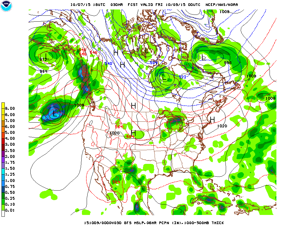
A tropical forecast track you just do not see every day. A system expected to retain tropical storm strength and status to near to near 40 degrees north latitude. That is pretty far north for our West Coast. And a tractable post-tropical storm to the coast of British Columbia late Thursday early Friday.

The little purple dot, center image east northeast of Hawaii is the hurricane. The advisory has the storm moving NNE at 41 mph. Image below is only 18 hours after image above, notice Hawaiian Islands are left far behind.
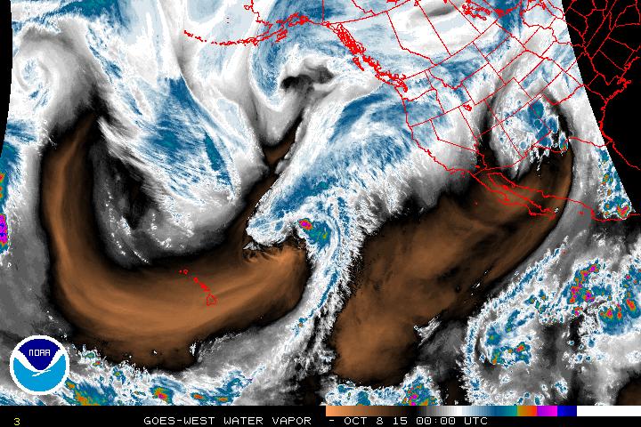
The storm is really moving, already passing west of Washington state late in the day on Thursday October 8th.
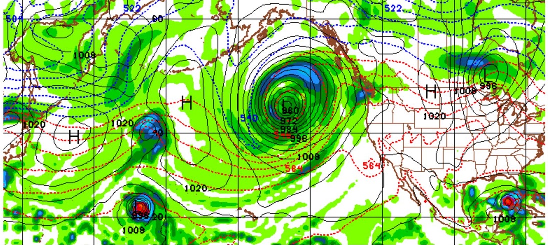
Finally, a quick tease illustrating that the long cool weather season has begun. There will be something to watch just about every day from now until spring.
GFS model for the Pacific at 300 hours or about 12 days out shows a 960mb low, similar to a Category 2 hurricane, some 600 miles from the Pacific Northwest. So, there is a possibility for two strong remnant tropical systems near the Pacific Northwest in less than two weeks. The purple dot near the tip of Cuba could become an interesting feature for Florida. Positive note: in this snap shot, most the United States actually pretty quiet.
The clean up and recovery has not even begun in South Carolina and new concerns are already on the distant horizon. Welcome to El Niño.
Learn more in my latest e-book El Niño: The WILD side of the weather cycle…
What we know, What we don’t, and Why you should care!
Wild Bill